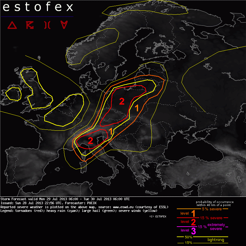
Alto rischio di fenomeni violenti a partire dalla tarda mattinata: vento, grandine e temporali forti altamente probabili, a mio avviso soprattutto nel sud regione....

... Northern Italy ...
With the rapid approach of the trough axis and attendant strong PVA already in the morning hours, storms might be already ongoing from the beggining of the forecast period, spreading quickly towards east . Even though CAPE values are not predicted to be very high (between 500-1500 J/kg), forcing factor will be unseasonably pronounced, compensating fo the lack of strong buoyancy. Vertical wind shear is forecast to be favourable for well organised convection, including supercells and bow-echoes, with bulk values in the 0-6 km layer between 20 and 30 m/s. Large to isolated very large hail, as well as damaging wind gusts might occur with any storm developing in this setup. An enhanced 0-1 km shear and SREH is forecast near the Gulf of Genoa around 09 UTC (with 850 hPa flow over 15 m/s), so that tornadoes will be possible with any sustained supercell in this area.